Category: Research

  • Marine Boundary Layer Cloud Boundaries and Phase Estimation Using Airborne Radar and In Situ Measurements During the SOCRATES Campaign over Southern Ocean

    Find it online: https://doi.org/10.3390/atmos16101195

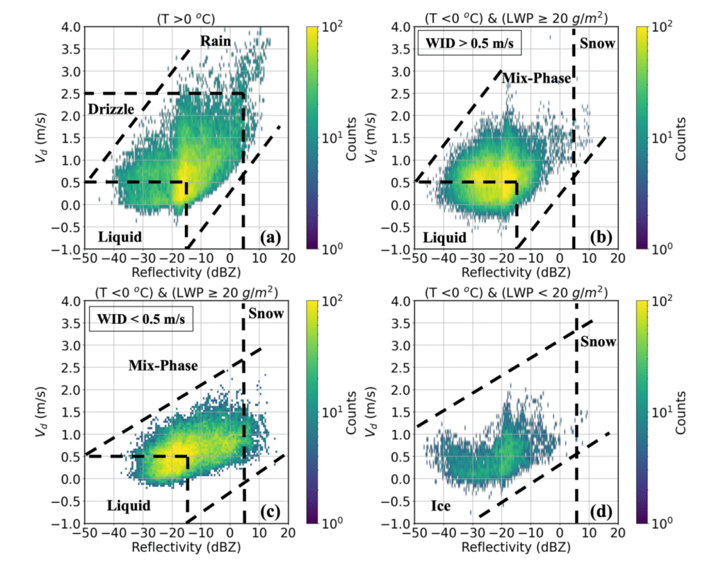
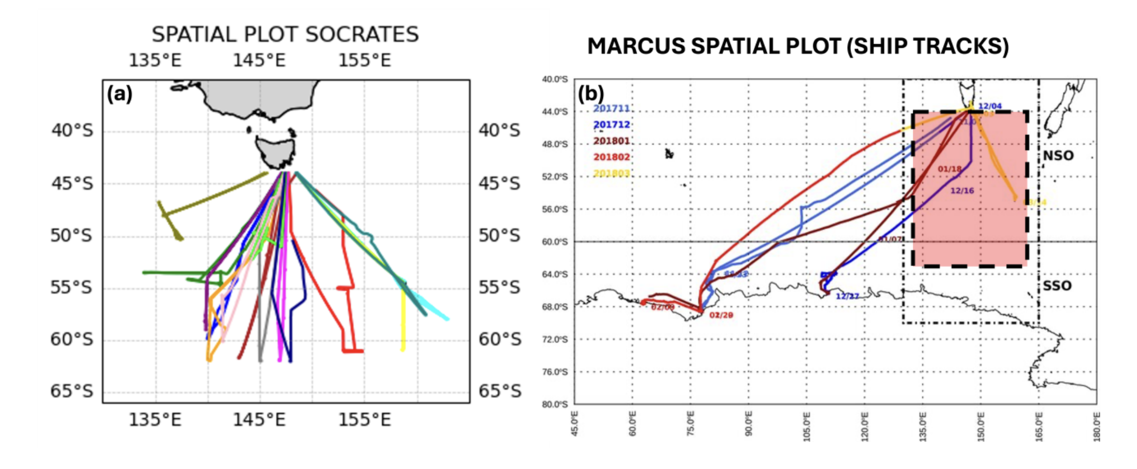
    The Southern Ocean Clouds, Radiation, Aerosol Transport Experimental Study (SOCRATES) was an aircraft-based campaign (15 January–26 February 2018) that deployed in situ probes and remote sensors to investigate low-level clouds over the Southern Ocean (SO). A novel methodology was developed to identify cloud boundaries and classify cloud phases in single-layer, low-level marine boundary layer (MBL) clouds below 3 km using the HIAPER Cloud Radar (HCR) and in situ measurements. The cloud base and top heights derived from HCR reflectivity, Doppler velocity, and spectrum width measurements agreed well with corresponding lidar-based and in situ estimates of cloud boundaries, with mean differences below 100 m. A liquid water content–reflectivity (LWC-Z) relationship, LWC = 0.70Z0.29, was derived to retrieve the LWC and liquid water path (LWP) from HCR profiles. The cloud phase was classified using HCR measurements, temperature, and LWP, yielding 40.6% liquid, 18.3% mixed-phase, and 5.1% ice samples, along with drizzle (29.1%), rain (3.2%), and snow (3.7%) for drizzling cloud cases. The classification algorithm demonstrates good consistency with established methods. This study provides a framework for the boundary and phase detection of MBL clouds, offering insights into SO cloud microphysics and supporting future efforts in satellite retrievals and climate model evaluation.

    Cite: Das, A., Xi, B., Zheng, X., & Dong, X. (2025). Marine Boundary Layer Cloud Boundaries and Phase Estimation Using Airborne Radar and In Situ Measurements During the SOCRATES Campaign over Southern Ocean. Atmosphere16(10), 1195. https://doi.org/10.3390/atmos16101195

  • Quantifying the Differences in Southern Ocean Clouds Observed by Radar and Lidar From Three Platforms

    Quantifying the Differences in Southern Ocean Clouds Observed by Radar and Lidar From Three Platforms

    Find it online: https://doi.org/10.1029/2024GL112079

    A synergistic analysis of the radar-only and combined radar-lidar observations across the three platforms was conducted. To align with well-calibrated CloudSat cloud profiling radar (CPR) (and HCR) reflectivity measurements, a constant 4.5 dB offset was applied to all M-WACR reflectivitives during the MARCUS. This brings M-WACR data into better agreement with both HCR and CPR reflectivity measurements and facilitates a more reliable cloud fraction (CF) comparison. The total CFs (CFTs) derived from the three radars show excellent agreement. All three radars detect large drizzle drops, but M-WACR and HCR excel at detecting smaller cloud droplets that are often missed by CPR. The underestimated CFs by CPR are due to increased attenuation of CPR measurements below 3 km, and the combined effects of attenuation and surface clutter below 1 km. Combining radar and lidar observations enhanced cloud detection by 20%–60%. The results from this study provide new insights for designing future cloud radar systems.

    Cite: Dong, X., Das, A., Xi, B., Zheng, X., Behrangi, A., Marcovecchio, A. R., & Girone, D. J. (2025). Quantifying the differences in Southern Ocean clouds observed by radar and lidar from three platforms. Geophysical Research Letters, 52, e2024GL112079. https://doi.org/10.1029/2024GL112079